- Home
WelcomeTravel EssentialsActivitiesOn The WaterOn The SnowEventsOther Fun InfoKeep In Touch
|
Map and Navigation Chart
of Lake Winnipesaukee
in New Hampshire
"The good life is inspired by love and guided by knowledge." ~ Bertrand Russell 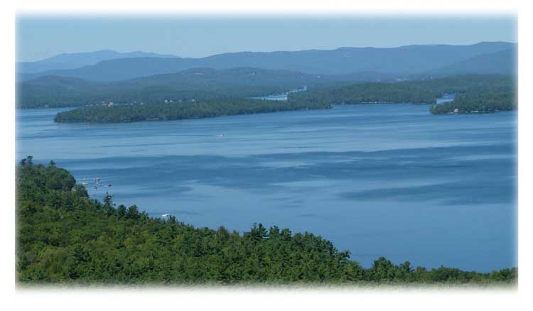 A map to help you navigate Lake Winnipesaukee in New Hampshire is a must for fishing and general boating. There are so many shallow areas, boulders and unknowns just below the surface in many areas. Buoys mark the places to stay away or to navigate around. If the buoy is a white spar with black on top, you pass to the north or east of it. If the buoy is a white spar with red on top, you pass to the south or west of it. How do you remember that? I found my own memory trigger. Basically it's usually hot in the South and West and red represents a hot color. It's usually colder in the north and east (at least in winter) and black can represent a cold color. This works for me! The solid color channel markers (red and black) are for the boats to pass between the buoy markers. You'll find all kinds of buoys on Lake Winnipesaukee in New Hampshire. So that you know where you want to go, a map or navigation chart can be your best friend in unfamiliar waters. The following is a list a some of the places that sell a Lake Winnipesaukee Navigation Chart: Alton, New Hampshire -
Downing's Landing, Alton Bay (at the bridge) -
Gillan Marine, Route 11, Alton Bay (at the bridge -
Minge Cove Marina, Route 11, West Alton -
Olde Bay Diner, Route 11 -
Parker Marine, Route 11, Alton Bay (at the bridge) -
Wayside Grocery at the traffic circle, one mile south of town -
West Alton Marina, Route 11 Center Harbor, New Hampshire -
Bayswater Bookstore, Route 25 -
Heath's Hardware Store, Route 25 Gilford, New Hampshire -
Ames Farm Inn, 2800 Lake Shore Road -
Dave's Motorboat Shoppe, Route 11B, 229 Intervale Road -
Fay's Boat Yard, 71 Varney Point Road (Smith Cove) -
Fay's Marine Store, 3 Varney Point Road, Route 11 (looks like an ark) -
Gators, Inc., Weirs Road (at Gilford shopping plaza) -
Silver Sands Marina, 103 Weirs Road -
Sports and Marine Parafunalia, 44 Weirs Road Laconia and Weirs Beach Area in New Hampshire -
Anchor Marine, on the boardwalk at Weirs Beach -
Channel Marine, Channel Drive, Weirs Beach -
Irwin Marine, 958 Union Avenue, Lakeport -
Lakeport Landing Marina, Corner of Elm and Union -
Paugus Bay Marina, 41 Sheridan Road -
Paugus Bay Sporting Goods, 135 Weirs Boulevard -
Thurston's Marine, Route 3, Weirs Beach (at the bridge to Paugus Bay) Meredith, New Hampshire -
AJ's Bait & Tackle, 23B Main Street -
American Heritage Laminating Company, Edgerly School Road -
Innisfree Book Store, Mill Falls Marketplace -
Meredith Marina, 2 Bay Shore Drive -
Meredith Station, (convenience store across from town docks) -
Shep Brown's Boat Basin, 31 Lovejoy Sands Road -
Y Landing Marina, 108 Powers Road Moultonboro, New Hampshire -
Conway's Bait and Tackle, Route 25 -
Dad's Supermarket, Route 109 -
Jojo's Country Store, Moultonboro Neck Road -
Moultonboro Country Store, Moultonboro Center -
Muphy's Mobil, Route 25, Moultonboro Neck Road -
Rob's Gas Depot, Route 25 -
Trexler's Marina, Moultonboro Neck Road (at Long Island Bridge) Tuftonboro, New Hampshire Wolfeboro, New Hampshire -
Black's Paper Store and Gift Shop, 8 South Main Street -
Dive Winnipesaukee, 4 North Main Street -
Goodhue & Hawkins Navy Yard, Sewell Road -
Wolfeboro Bay Outfitters, 15 Main Street -
Wolfeboro Corinthian Yacht Club If you use the navigation chart a lot, you might want to get another to have as a wall map in a frame to help plan out your New Hampshire boating or fishing excursions. 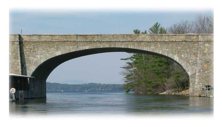
|


